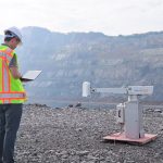
Adept delivers advanced surveying and mapping solutions for high-accuracy data collection and detailed project models.
Adept offers professional UAV platforms for efficient, high-precision aerial surveying and mapping.
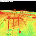
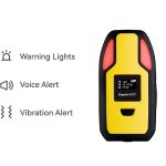
Cutting-edge technology for real-time surveillance of terrain stability in mining sites. Through continuous monitoring and analysis of ground movement.
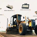
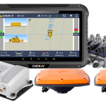
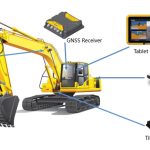
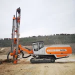
Adept provides precision 3D GNSS control for excavators, bulldozers, graders, and drilling.
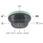
Adept supplies robust, reliable CORS network solutions for seamless, high-precision GNSS positioning across any site.
Explore real-world results with Adept's case studies on machine control, surveying, and UAV success stories.
Talk to Us